
Tonight the area of low pressure east of Belize is becoming better organized and almost all of the
models are starting to agree that we will see a depression form in the next 36 hours if it hasn't already. Satellite
images show a nice area of convection really getting its act together today. This system is forming in almost the exact same location and date as our first storm of 2005,
Arlene. This is just an eerily similar start to the 2006 Hurricane season. Everyone is worried that 2006 could be just as bad or worse than 2005 and this should fuel those discussions even more. Current model tracks have this storm coming into Florida next Wednesday somewhere north of Tampa Bay. By this time tomorrow we should have a better idea of what we may be dealing with as far as how strong of a storm this may end up becoming. The National Hurricane Center put out a special
statement at 5:30pm EST today for everyone on the Gulf Coast to get prepared. There is no doubt that the water north of the Yukatan Gap is very
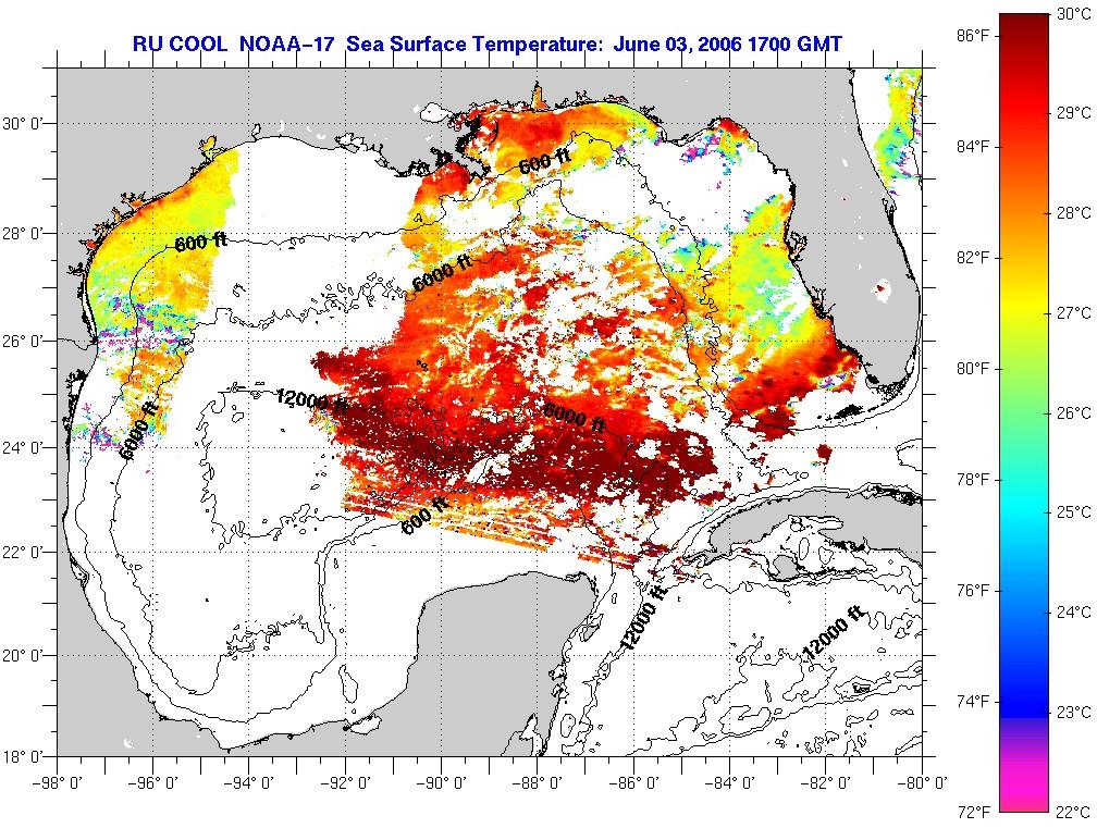
warm, so there is some concern that this could become a Hurricane. The area of High Pressure that has been dominating the Gulf of Mexico is forecast to dissipate which will open up a path for this storm as well as remove the dry air that could suck the moisture out of this system. Stay tuned. I guess I take back my prediction that this season would start off slowly. It looks like we may be getting this season started at the same time as last year. That is scary. Here is the surface map for how the system may be setting up.
SCM
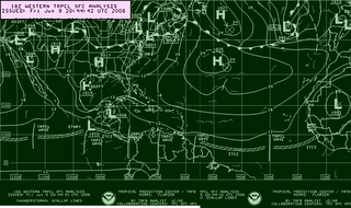
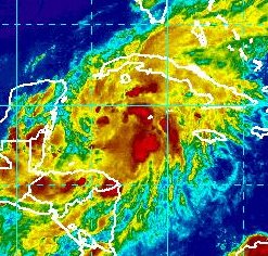 Tonight the area of low pressure east of Belize is becoming better organized and almost all of the models are starting to agree that we will see a depression form in the next 36 hours if it hasn't already. Satellite images show a nice area of convection really getting its act together today. This system is forming in almost the exact same location and date as our first storm of 2005, Arlene. This is just an eerily similar start to the 2006 Hurricane season. Everyone is worried that 2006 could be just as bad or worse than 2005 and this should fuel those discussions even more. Current model tracks have this storm coming into Florida next Wednesday somewhere north of Tampa Bay. By this time tomorrow we should have a better idea of what we may be dealing with as far as how strong of a storm this may end up becoming. The National Hurricane Center put out a special statement at 5:30pm EST today for everyone on the Gulf Coast to get prepared. There is no doubt that the water north of the Yukatan Gap is very warm, so there is some concern that this could become a Hurricane. The area of High Pressure that has been dominating the Gulf of Mexico is forecast to dissipate which will open up a path for this storm as well as remove the dry air that could suck the moisture out of this system. Stay tuned. I guess I take back my prediction that this season would start off slowly. It looks like we may be getting this season started at the same time as last year. That is scary. Here is the surface map for how the system may be setting up.
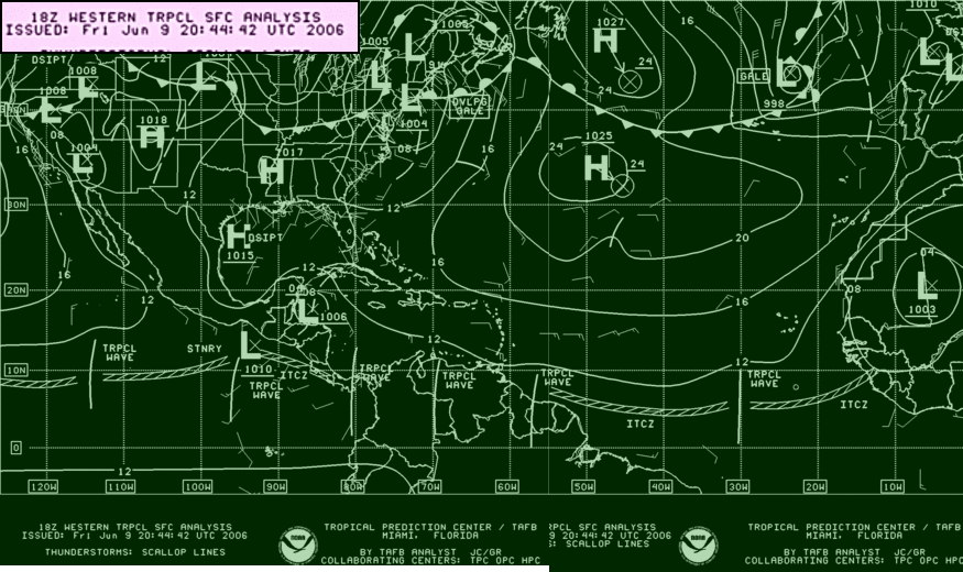 SCM
SCM


No comments:
Post a Comment