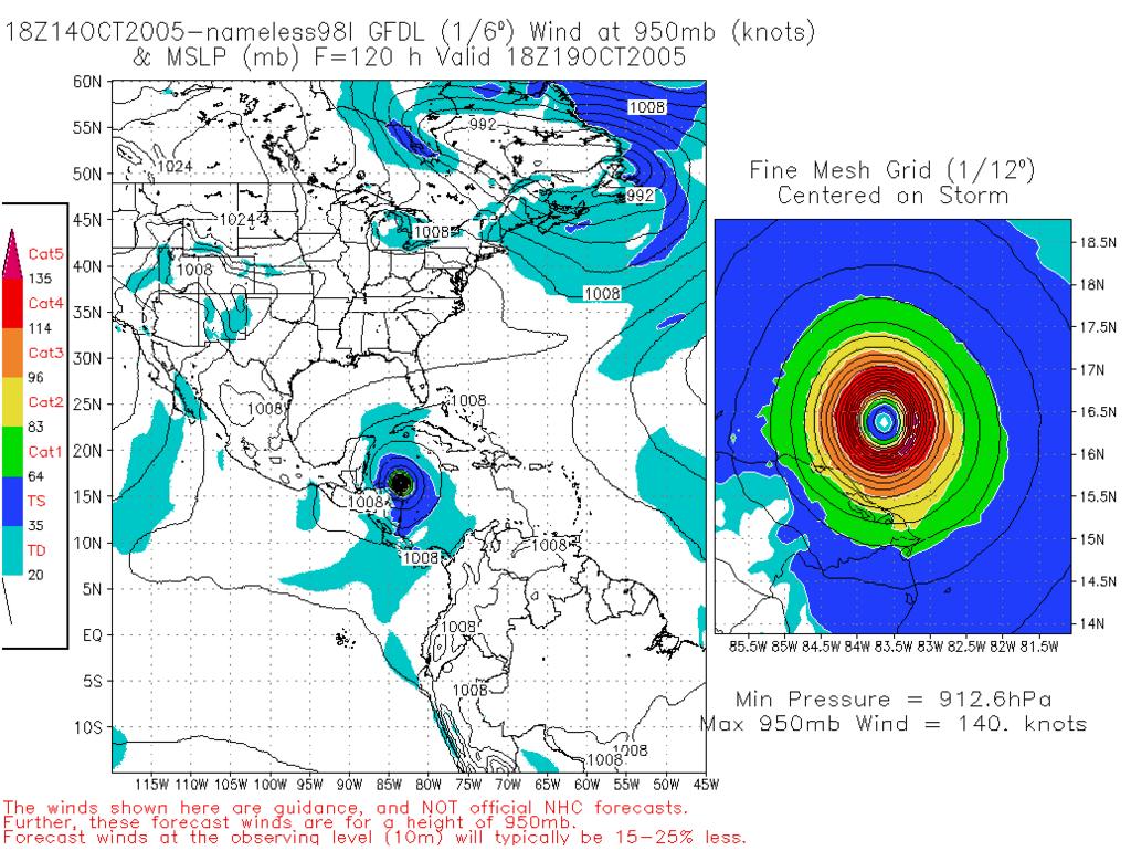
 After a bit of a break in tropical activity over the last couple weeks, we are once again faced with the threat of another major hurricane in the Caribbean. Just south of Jamaica 98L.Invest is brewing and conditions are becoming very favorable for development. Unfortunately, the model tracks at this point are wildly divergent. Currently their is strong high pressure in the Gulf of Mexico that is currently pushing this system to the WSW, but this High is forecast to weaken and allow the system to move more northerly into the Gulf of Mexico. Joe Bastardi is predicting this to be a major hurricane for western Florida. His reasoning is that this High in the Gulf of Mexico is going to shift east allowing the storm to move in more of a northerly direction over time. Most models are pushing it more in the direction of Central America and Yucatan Channel. The GFDL model run from this morning is showing this system developing into a Cat 5 hurricane over the next 120 hours and slamming Central America. The last hurricane to hit this area with such force was Hurricane Mitch, which killed over 9,000 people. After the massive flooding in the Guatemala area from the remnants of Stan, this could be a horrendous situation.
 Observations from this morning do show some strong 20kt wind shear to the north of the system over Cuba, which is also pushing some dry air into the developing Low. The models this season have been pretty unreliable until a low pressure system actually forms, so we take the GFDL run with a grain of salt. It did get my attention while I had coffee this morning. Only thing we can do at this point is watch this system closely and prepare. Everyone from Florida to Central America is at risk for this system that is forecast to quickly develop over the weekend. Stay tuned, Wilma may be here shortly.
SCM


No comments:
Post a Comment