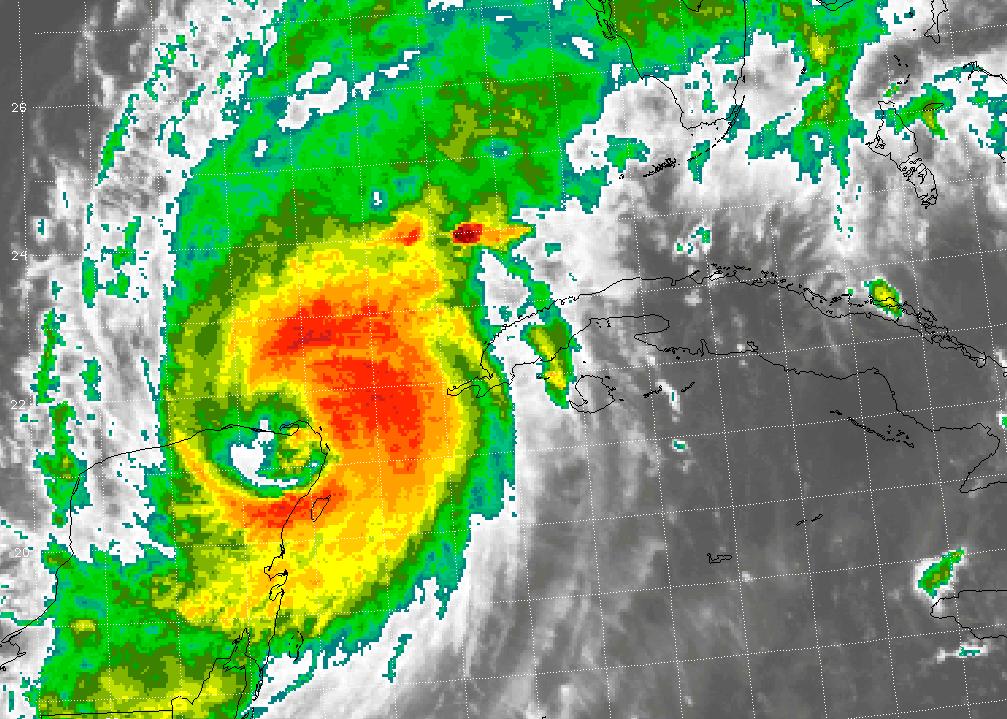
 The 5pm forecast track for Wilma has just been released. The latest track now speeds up the arrival in Florida with a landfall now early Monday morning. Additionally, Wilma has not weakened as much as hoped for over the Yucatan. It is now possible that Florida will be dealing with a Major Hurricane in less than 48 hours. The track has remained rather steady the last 2 days, focusing in on Fort Myers, Florida. Hurricane watches are now active from Longpost Key south to Key West Florida. Watches have also been issued for the east coast of Florida as well. This is probably due to the fact that a stronger hurricane is expected to make landfall, increasing the likelihood of hurricane force winds on both coasts. Residents on the southern eyewall of Wilma will experience the brunt of the storm. Tropical Storm force winds will likely cover a large portion of the state as they extend out over 200 miles, with hurricane force winds extending approximately 85 miles. Aiding to the power of the winds will be the strong flow aloft in the upper level winds from the trough pulling Wilma across Florida. Last night we had strong thunderstorms here in North Carolina and it was 58 degrees outside. Hail, strong winds and severe lightning lasted for about 2 hours. This was caused by the same trough that will pull Wilma across Florida. It is strong.
As the eye has started to move off the coast of the Yucatan, we will soon be able to start the aftermath assessments and clean up from Wilma. I am holding my breath waiting for these reports. I expect the news and damage to be severe. It will take up to a year for Cozumel, Playa del Carmen, and Cancun to recover from the 36 hours under Wilma.
What else can I say as I sum up other than we have another record for 2005. Tropical Storm Alpha is now official. This is the 22nd named storm of the season, breaking the all time record. Truly an amazing statistic! Unfortunately, we still have over 5 weeks left in this hurricane season. The final tally is yet to be known. We will keep an eye on this system as it develops, but most likely it will be pulled into the offshore flow behind Wilma and go out to sea. Puerto Rico could end up getting huge amounts of rain along with Tropical Storm force winds. It looks unlikely that this system will affect the US mainland.
SCM


No comments:
Post a Comment