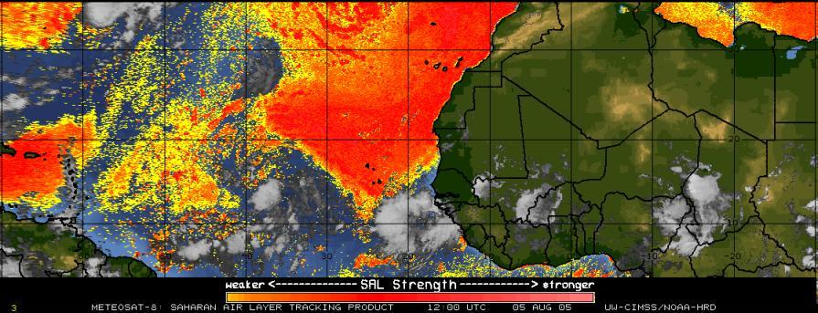
If you read the 11am discussion from the NHC on TD09, they have really changed their forecast. Yesterday, it was pretty well organized and picking up strength even though it was still over slightly cooler waters. Tropical systems generally need water temperatures above 28C to really pick up strength. Well today TD09 is really looking weak and is not nearly as impressive. It looks like the culprate is the ever present African Dust that has been in the Atlantic this season. If you watch this image loop you can really see the dust get wrapped into the system, which soaks the moisture out of it like a sammy mop. Another factor appears to be Harvey. Harvey is quickly pushing away to the NE. Their is a large ULL that is to the SE of Harvey. Harvey has started to push that ULL down into TD09 causing even more dry air to get into the system today. TD09 definitely doesn't have the potential that it did 24 hours ago, but this could change over the weekend. The 5 day forecast track has been shifted much more towards the NW by the NHC at 11am today. Potential for any problems from this system continue to be minimal in my opinion, but we will continue to watch it.
SCM
*Note - This post is not done by a professional Meteorologist and should not be used for making decisions on safety and protection of property. Always use your local National Weather Service station or the National Hurricane Center for up to date weather information and data.*


No comments:
Post a Comment