 The NHC has nailed the northwest and north movement of Irene, and you can officially put a fork in this storm. Irene is going fishing and won't touch the US mainland. NC residents are breathing a sigh of relief after facing the first storm threat of 2005. Irene has been a bizarre storm. It has survived when it was supposed to die, but never truly got a strong area of convection developed for a sustained period of time. Conditions across the Atlantic have never been favorable, but Irene has pushed as far across the ocean as she could. In the end the high pressure ridge that was supposed to push Irene west was never as strong as predicted. Irene won't make it past 70W and will soon be history.
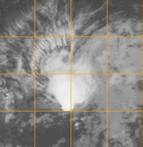
There is no time to relax and take a deep breath, Tropical Depression 10 is on the horizon and is looking like a much healthier storm. The next name on the board is Jose, and TD10 will soon assume this name. The same Bermuda high that played a role in the final outcome of Irene will also have a big stake in what happens with TD10. The current forecast track has TD10 pushing WNW to just north of the Windward Islands, where it could be stalking the East Coast and Florida in 10 days.
On a personal note, strong storms are predicted for central North Carolina tomorrow, so I will be attempting to capture some more photographs. Check back tomorrow evening.
SCM


No comments:
Post a Comment