 As Emily comes ashore and finally leaves our Radar after 9 days of tireless storm tracking, we thought we would soon be able to put a record setting July 2005 behind us. I need a nap. As I tracked Emily coming ashore last night, a new tropical wave caught my eye in the Eastern Caribbean near Puerto Rico. Sure enough July 2005 may not be done yet.
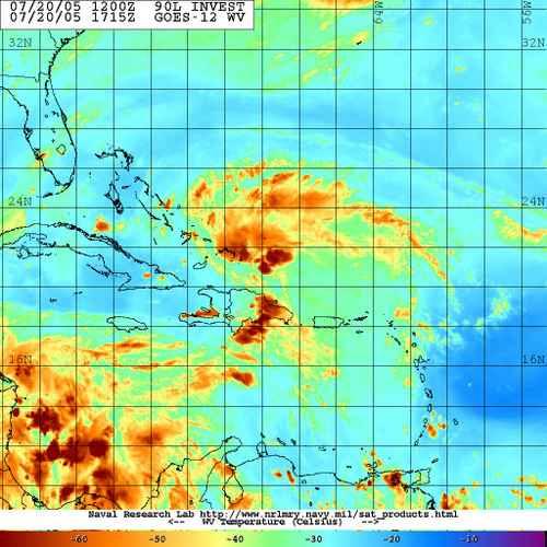
This morning the NOAA Hurricane Hunters posted their Schedule for Tomorrow and they are heading in. If I am tired, I can't imagine how they feel. They have named this new Tropical Wave 90L.Invest and it has its sights set on
The fact that we could have 6 named storms in 2005 before August even gets here clearly shows us that there will be no rest for the weary in Hurricane Season 2005.
On a side note, its 93 degrees here in
Updated: It appears that the models have been run on 90L.Invest and here is what they are saying currently for this storms future track.

SCM
*Note - This post is not done by a professional Meteorologist and should not be used for making decisions on safety and protection of property. Always use your local National Weather Service station or the National Hurricane Center for up to date weather information and data.*


No comments:
Post a Comment