727 AM EDT SAT OCT 25 2008

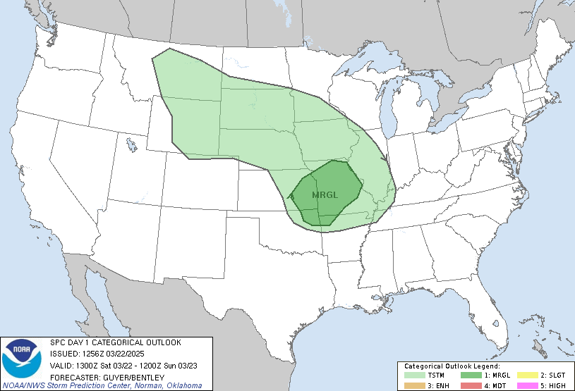
THIS HAZARDOUS WEATHER OUTLOOK IS FOR COASTAL NORTHEAST NORTH
CAROLINA...INTERIOR NORTHEAST NORTH CAROLINA...THE NORTHERN OUTER
BANKS OF NORTH CAROLINA...INTERIOR SOUTHEAST VIRGINIA...SOUTH
HAMPTON ROADS VIRGINIA...THE EASTERN SHORE OF VIRGINIA...THE MIDDLE
PENINSULA OF VIRGINIA AND THE PENINSULA OF SOUTHEAST VIRGINIA.

.DAY ONE...TODAY AND TONIGHT.

A CHANCE OF THUNDERSTORMS WILL BE POSSIBLE...MAINLY THIS
AFTERNOON. DAMAGING WINDS IN EXCESS OF 58 MPH WILL BE THE MAIN
THREAT IN ANY STORMS THAT DO BECOME SEVERE. AN ISOLOATED TORNADO
WILL ALSO BE POSSIBLE.

.DAYS TWO THROUGH SEVEN...SUNDAY THROUGH FRIDAY.

NO HAZARDOUS WEATHER IS EXPECTED AT THIS TIME.

.SPOTTER INFORMATION STATEMENT...

SPOTTER ACTIVATION IS NOT ANTICIPATED AT THIS TIME.

$$
Saturday, October 25, 2008
Hazardous Weather Outlook
First time in months! We'll see how things develop today.
Subscribe to:
Post Comments (Atom)


2 comments:
WooHoo Mikey!
Sending stormy vibes your way. :D
"MODEL GUIDANCE AND SURFACE OBSERVATIONAL TRENDS SUGGEST THAT STORMS WILL HAVE GREATEST RISK OF ATTAINING SEVERE INTENSITY AS THEY APPROACH THE COAST OF SOUTHEAST VA/NORTHEAST NC WHERE STRONGEST INSTABILITY/MOISTURE WILL BE PRESENT."
I really enjoyed reading your storm chasing blog this morning. It was very helpful and your writing is fun and easy to read. You seem to have a really strong following and are clearly an expert on all things weather!
I’m with Examiner.com and think we could provide you with a great opportunity to expand your audience. I searched through your site to find contact information but couldn’t find anything, so please forgive me for posting on your comments.
I encourage you to take a look at Examiner.com and see what some of our Examiners are doing in your area.
If you like what you see and think you’d be a good fit, feel free to submit an application to get the ball rolling.
If you have any questions, feel free to contact me at ExaminerMelissa@gmail.com.
Post a Comment