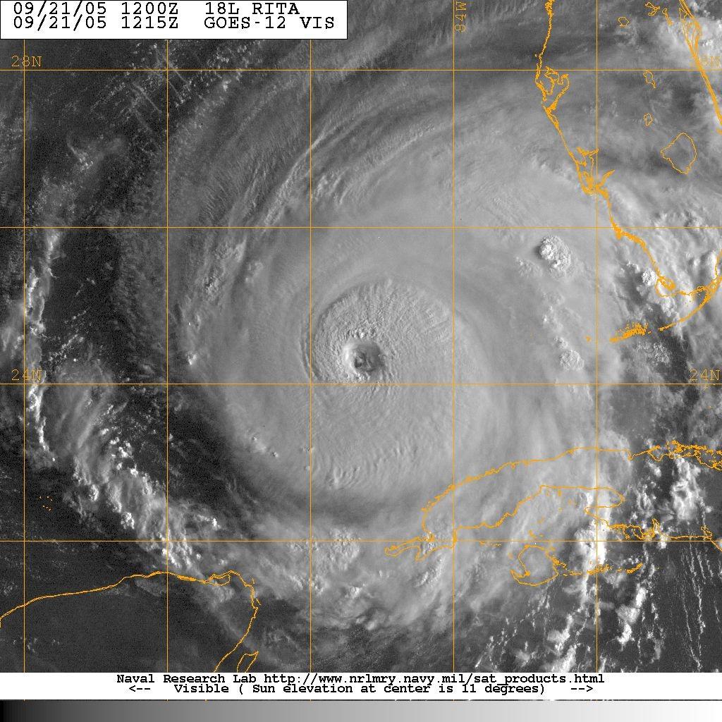
 This morning we woke up to another very dangerous Category 4 hurricane in the Gulf of Mexico headed towards a heavily populated area. Only time will tell if Rita ends up being Katrina part 2, but it is certainly a very realistic possiblity. At the beginning of the hurricane season we knew we had an increased risk of major hurricanes this year. The thing they don't tell us in these forecast is if the storms will head towards the most vulnerable areas on the US coastline. The chances of a Category 4 hurricane hitting both New Orleans and Galveston in the same year have to be pretty low. Today the facts are that this may happen and we will all feel the affects of it.
The first problem we have is the forecast models have been clustering around the Galveston area for over a day now. We had plenty of warning with Katrina and today we have plenty of warning with Rita. Galveston has a population of around 300,000 and Houston is the 5th largest city in the US at around 4 million. That is a lot of poeple to move and get out of the way of this major hurricane. Once again the decisions and planning of the local, state, and federal government will be looked at closely for years to come. From what I see on TV today, Texas is taking this very seriously and forcing people out. Schools are closed so the buses can be used to evacuate residents. Nursing homes are being cleared out this morning. It appears that people are getting out of the way. Watching this play out on TV the next couple of days will be very interesting, the spotlight is on Texas.
The forecast variables are surrounding the high pressure system to the north of Rita. There is a very strong ridge of high pressure to the north of Rita, which the hurricane is traveling to the west on the south side of this ridge. When you have a high pressure ridge to the north of a major hurricane, it is called an anti-cyclonic pattern. The high pressure ridge is actually helping to strengthen the hurricane considerably. This is due to the fact that the winds on the south side of the high and the north side of the hurricane are both traveling from east to west. Therefore the two systems are actually helping each other. This is why the NHC is forecasting this storm to stay a category 4 or 5 hurricane until landfall. There is no dry air, there is no wind shear, there is no upper level low around the hurricane to help impede its progress. The runway is basically clear all the way to the coastline. The turn to the NW into Texas will all depend on how fast the High pressure ridges moves to the east and how quickly Rita travels to the West. It is all timing at this point.
 The area where all of us will feel the affects of Rita is at the gas pump. Gas jumped .40cents this morning at local North Carolina gas stations. Experts are saying that $4.50-$5.00 a gallon is not out of the question if Rita rakes the energy coast along NE Texas. The affects that gas price will have on the economy is pretty drastic, so this is a storm that we all need to watch and will affect everyone. This map shows all the pipelines and refineries in the NE Texas/SW Louisiana area. I filled both of my tanks up last night at $2.98 a gallon.
SCM


2 comments:
Hey SMC...Just let Angel out in the yard....we got good storms and rain last night....quite a show of lightening.....the number of strikes in the hampton roads area was phenomenal.....but we needed the rain.....thanks for the great info on the new hurricane...i fear it is a biggie also....just put gas in the little red car....2.78 a gallon but i figured if Rita ravages the oil rigs and refineries like it may, gas will "explode" to an even higher cost than post Katrina....oxoxox hold fast ghee
sorry..that should have been hey scm not smc....but you get my drift....as always...hold fast ghee
Post a Comment