Yesterday we talked about whether or not that
trough coming out of the Midwest would be strong enough to push Franklin into the Atlantic where it could go fishing and leave us alone. It appears today that is the case and the NHC has updated their
current forecast to show that trend. If you watch the
satellite loop closely, you will see the trough diving down from the Great Lakes towards Franklin. In the last few satellite frames you can see the storm actually starting to move more North as it is affected by this system. Franklin has been tracked across the Atlantic as originally 99L.Invest and it has survived many disruptions, will it come back or just go away? We will continue to watch it. Cloud tops have cooled this morning showing growing Thuderhead activity around the center, but the SW quadrant of the storm continues to be sheard. Franklin's timing may not be good and he may be going fishing.
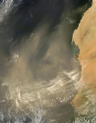
On a seperate note, there was a very interesting area of dry air moving across the Atlantic from Africa that has sucked all the moisture out of every system near it. This is what is referred to as an African Dust storm and they look like this.
Here is a great article on this rare event. Get your cameras out as the Sunrise and Sunset pics in South Florida should be outstanding.


No comments:
Post a Comment